ACCURATE 3D FROM YOUR 360 CAMERA OR PHONE
We provide an engineering grade photogrammetry capture system for 360-degree cameras and smartphones, allowing you to quickly create, access, and share accurate point scans and thousands of site images directly through your web browser.
Capture
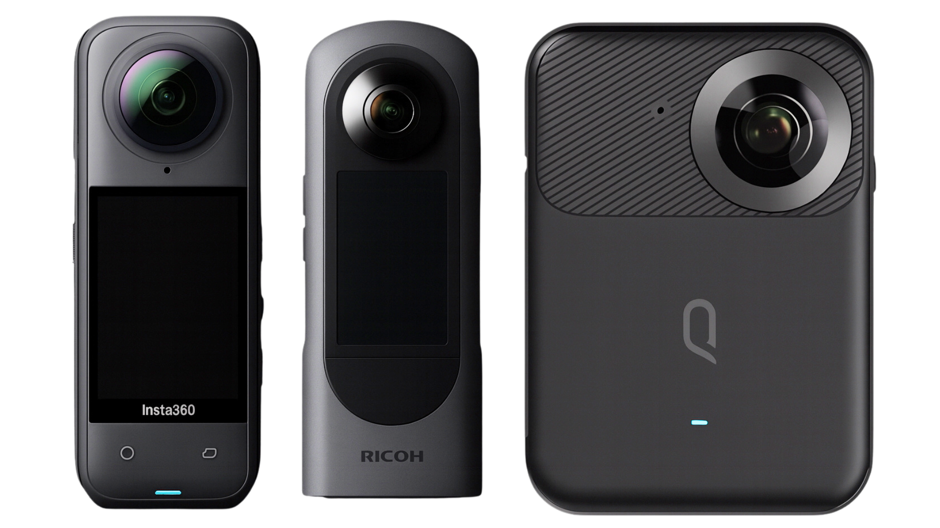
Use your existing 360 cameras or Android and iOS smartphones to capture a detailed site record within minutes. We support 360 video from Insta360, Ricoh and Kandao cameras.
Process
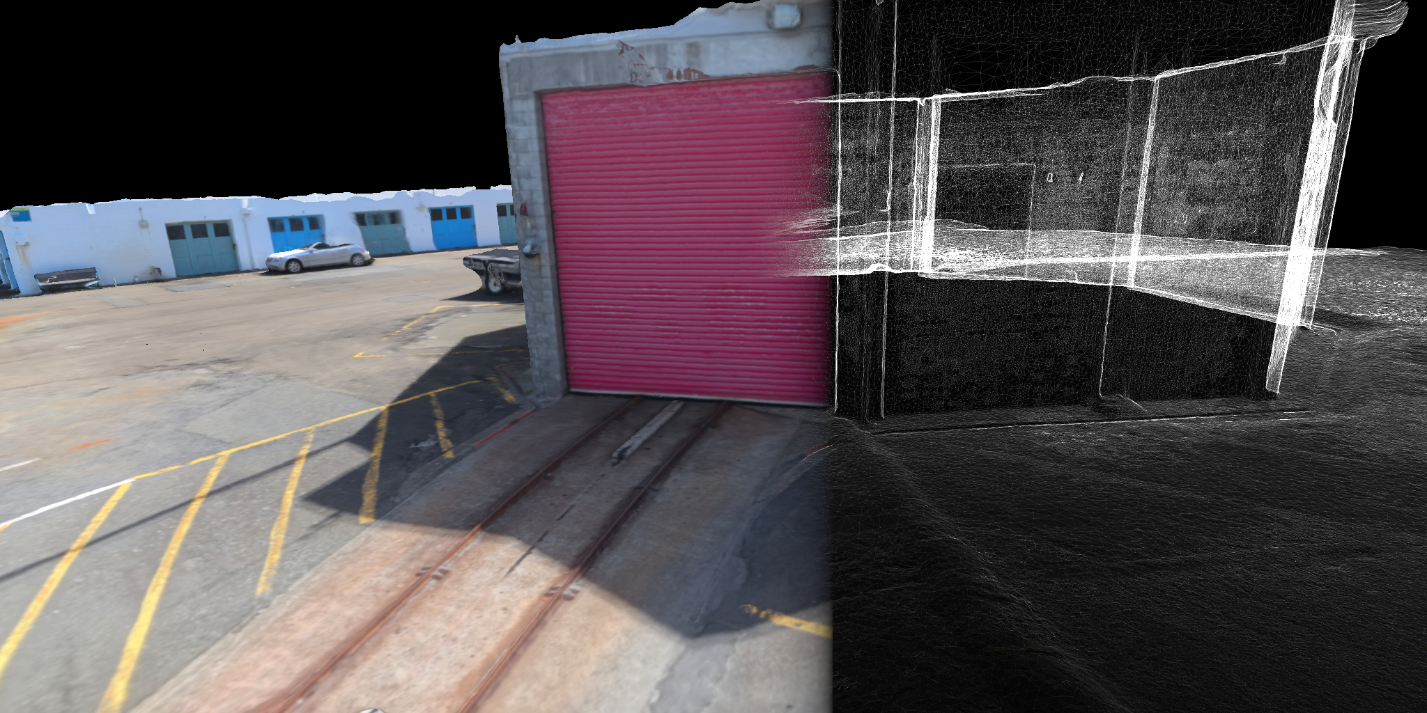
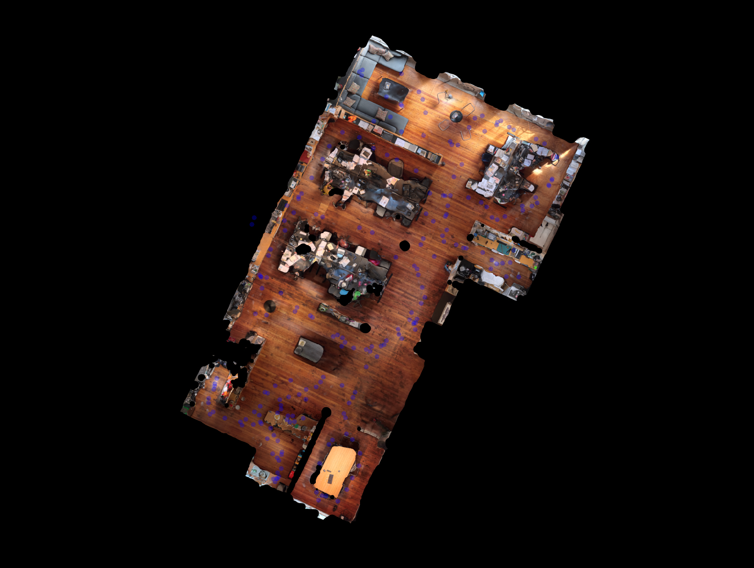
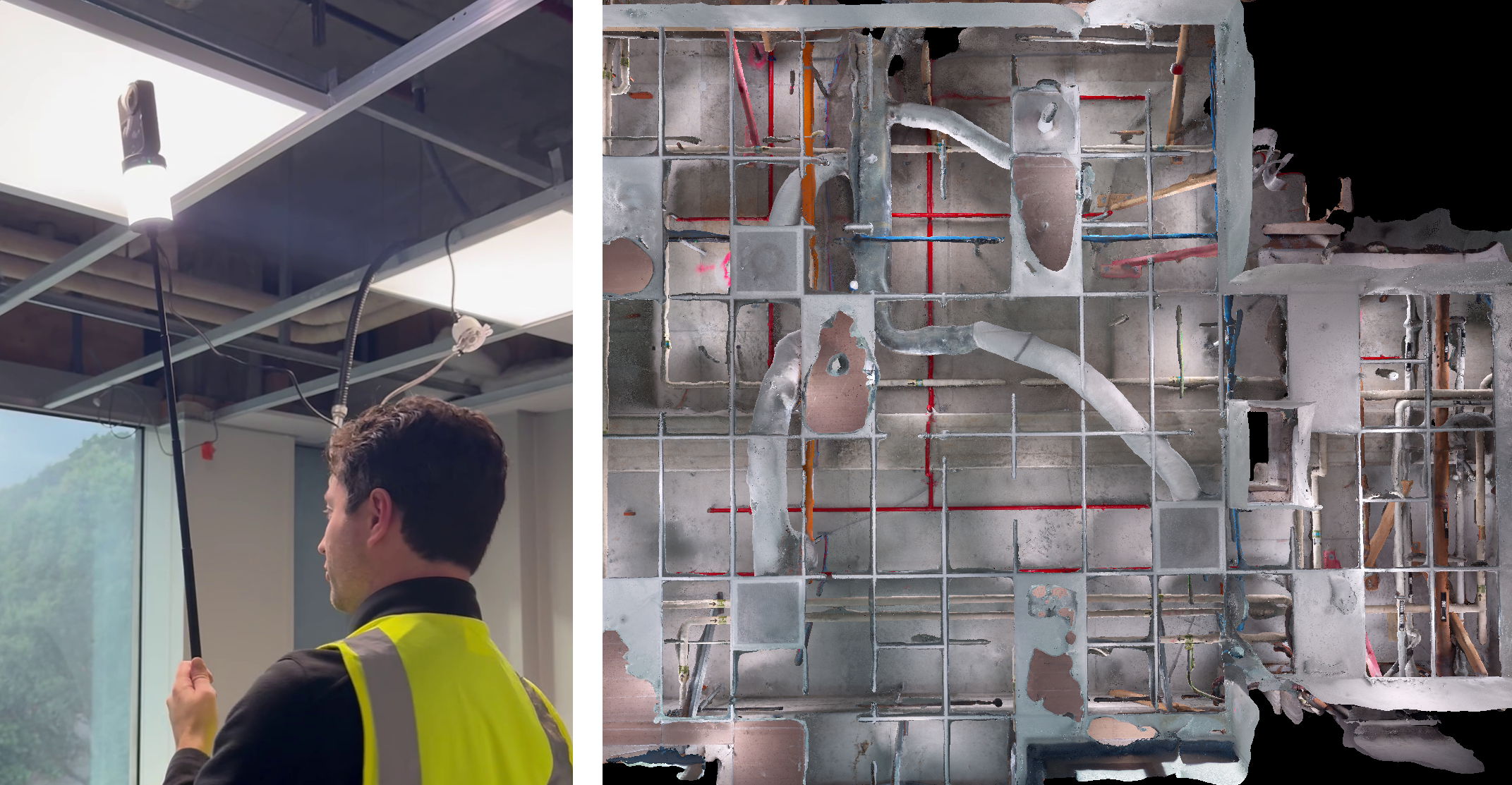
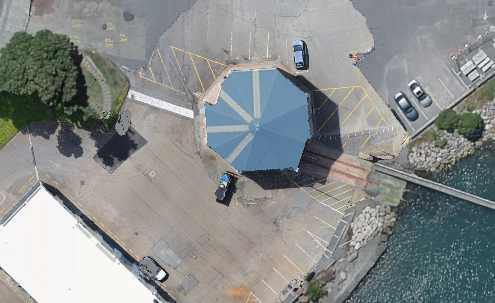
Sensori's advanced photogrammetry technology will automatically process video data into high detail 3D models with accuracy that can exceed expensive SLAM scanners.
View and Share
Our convenient web viewer with seamless navigation of large point clouds and panoramic images makes measurement, visual inspection and sharing easy.
Safety
Using lightweight 360 cameras for data capture makes it easy to reach ceiling voids, manholes and other difficult to reach spaces.
Export
Your processed 3D data can be downloaded in a variety of industry standard formats for scan-to-BIM and GIS workflows including E57 point clouds with accurately located images, GLTF meshes and geotiff ortho images.
API
The power of Sensori's cloud photogrammetry solution can also be accessed via API for automated submission and retrieval of data. Build powerful automated workflows or add value to your existing 360 footage.

Get in touch for a free trial or to learn more about how Sensori’s 3D capture technology can help with design, site documentation and as-built verification.
Partners and Customers


